Admittedly, I didn't do any finishing work in the town area, but the TC2M modded map of Bath is pretty much done. He is a tour of Bath, which may help players as they think about strategies and tactics for the coming engagement in the
B & O WINTER command simulation.
 |
| This legend corresponds to the screenshots below. |
 |
| Looking up St. Johns Run Road from the Depot. Sir Johns Run is to the left of the road and then forded by the road in the distance. The white house is the southern most structure in the group of buildings at the depot. |
 |
| Looking towards the depot down St. Johns Run Road. The hills in the distance are on the other side of the Potomac. |
 |
| The curve in the road between the Thurston Farm and the Depot. |
 |
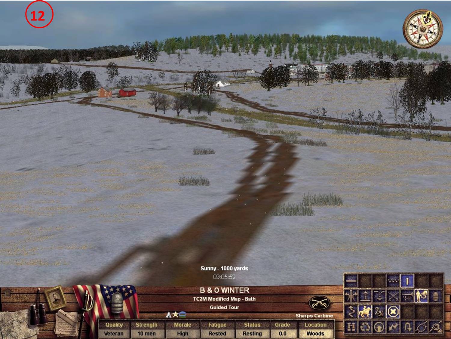
| The Thurston Farm, looking north up St. Johns Run Road. |
 |
| The Thurston Farm looking South down St. Johns Run Road. The S. Wilson Farm is visible in the distance. |
 |
| The S. Wilson Farm at the junction of Sir Johns Road and Cacapon Road. Looking towards the Richie Farm (with the red barn). The Strickland Farm is also visible on the wooded ridge in the distance (right center). |
 |
| From the S. Wilson Farm looking towards town. The J. Wilson farm is visible in the valley below. |
 |
| Looking down the small road in the direction of the Riggs Farm (not visible). The rise to the left is the south end of Warm Spring Ridge. |
 |
| The Riggs Farm looking north. |
 |
| The Strickland Farm looking north towards town. S. Wilson is visible on the ridge below at the top left. The Richie and J. Wilson Farms are also visible before town with the red and white barns respectively. |
 |
| The Richie Farm looking towards S. Wilson. The Cacapon Road crosses Warm Spring Ridge at its lowest point. |
 |
| Looking toward Richie, J. Wilson, S. Wilson, North Warm Spring Ridge and Bath Town from a position slightly north of the Berry Farm. |
 |
| The Rutherford Farm looking toward Richie. A branch of Warm Spring Run is to the left of the road. |
 |
| The back of the J. Wilson Farm looking towards the ridge and town. |
 |
| The Hammond Farm, looking toward the southeast corner of town. |
 |
| The Hughes Farm looking towards Dent. The church and building at the southwest corner of town are visible, but the Pendle buildings and southeast corner of town are concealed by the hill to the front. |
 |
| The Dent Farm. Pendle is fully visible, as is the entrance to town along the Martinsburg Road. |
 |
| The southeast corner of town, looking towards Hammond. Dent Hill is visible to the rear left of Hammond, which is at the southwest slope of the hill. |
 |
| The center of town looking down the valley towards J. Wilson. |
 |
| A view of J. Wilson and Richie from the ridge behind the southwest corner of town. |
 |
| Looking out of town along the Martinsburg Road towards Pendle and Dent. |
 |
| From the ridge behind town. |
 |
| Looking down the Hancock Rd. towards town from the north school. |


No comments:
Post a Comment