Instructions have been sent out to each side to do the following:
- Confirm the opening location of each unit (January 31, 1862)
- Confirm the location of available supplies and any added depots
- Assign supply train guards and indicate from which units they will be detached.
Due to some delays on my part, followed by the players being unavailable at different times through June, the simulation will start at the end of June. I should be fully ready by the time orders are issued, which should be in around the middle of the month.

Wednesday, May 31, 2017
Sunday, May 28, 2017
Campaign Theatre Guide Ready
At long last... the new Campaign Theatre Guide for TWWII has been posted under the Player Resources and Campaign Map pages. It includes locality maps and distances between localities and is a valuable resource for conducting the campaign.
Next steps: I will get all of the locality maps posted and then work on my spreadsheets for tracking movement and losses through the campaign.
Next steps: I will get all of the locality maps posted and then work on my spreadsheets for tracking movement and losses through the campaign.
Tuesday, May 23, 2017
And some more....
As I am reviewing the maps while preparing the Campaign Theatre Guide, I keep making minor revisions to align the maps with each other and the campaign map as much as possible. Reese's Mill and Hanging Rocks have been re-issued with some minor labeling changes.


More Revised Maps
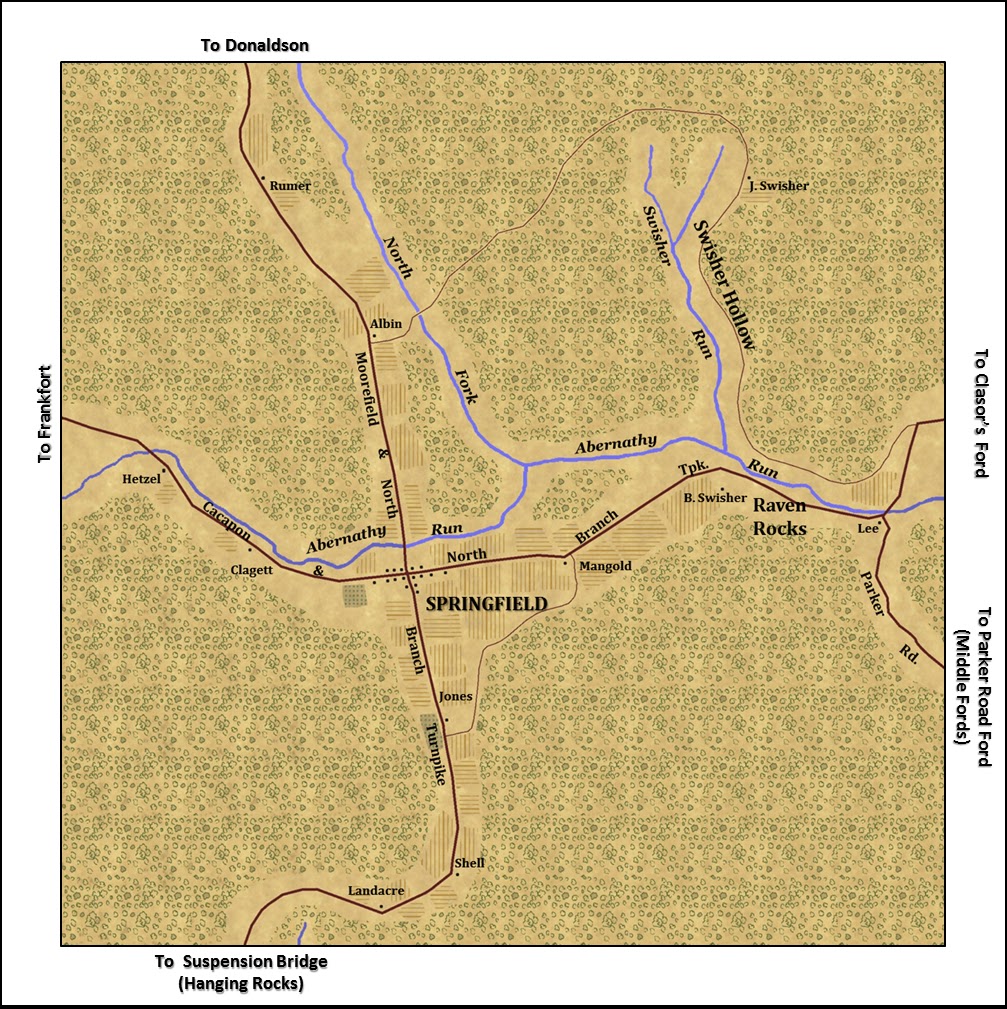
Minor changes have been made in the labeling on the Clasor's Ford, Donaldson, and Springfield Maps and they have been uploaded. There are no other changes to the map, only road names on the minimaps.


Revisions in Northwest Sector
As I was working on distance tables (distances between localities), I saw the need for some corrections to align locality maps to the campaign map in the northwest sector. The following maps have had some minor revisions for TWWII and have been uploaded onto the mods page:
BOW_Cresaptown2
BOW_Cumberland2_Working_Draft
BOW_Short_Gap2


BOW_Cresaptown2
BOW_Cumberland2_Working_Draft
BOW_Short_Gap2
Wednesday, May 17, 2017
Still Discussing Start Date
As it turns out, several players will not be available through June. We are looking a different start dates. One option was to start earlier and then take a break in June. Another options is to kick it off as we go into July.
Tuesday, May 16, 2017
Additional Maps Coming.... Later....
I am getting ready to start on the revised campaign theater guide. I do not intend to issue a map for Toll House or the depots between New Creek Depot and Cresaptown. I will issue TC2M modded maps for Harrison's Mill, Laurel Dale, Good, Blues Gap, and Cacapon Bridge. Blues Gap and Cacapon Bridge will be based on UGGS topographic maps. The others will use proxy maps.
Here are what the maps will look like:


Here are what the maps will look like:
Saturday, May 13, 2017
Gerlock uploaded, Green Spring Depot revised, New Package for TWWII
Gerlock (a fictional map). It uses an additional package, which will be needed for anyone running the BOW Mod during the TWWII simulation. The new package is called BOW_2.dat and is simply added to your package folder in your TC2M directory.
Green Spring Depot has been re-issued as Green_Spring_Depot2. The only change are labels on the minimap, showing Bear Hill Road (which leads to Gerlock, and the South Branch Bridge.


Green Spring Depot has been re-issued as Green_Spring_Depot2. The only change are labels on the minimap, showing Bear Hill Road (which leads to Gerlock, and the South Branch Bridge.
 |
| Union troops marching south past the church. |
 |
| Burnt House |
 |
| P. Gerlock house from the rear, looking southeast down the Town Creek Road |
Thursday, May 11, 2017
Next Steps...
Last night I started working on the (fictional) Gerlock map. I will probably finish and upload that map over the weekend and then shift to the Campaign Guide for a while and start figuring out and entering the distances between localities.
Wednesday, May 10, 2017
Flintstone Uploaded
Flintstone has been uploaded.
The Campaign Map has also been revised and the new version is available for download. The changes are very minor:
1. A road from the MD side of the Potomac across from Okonoko to Flintstone
2. A fictional homestead called "Gerlock" marking a junction that connects Town Creek, MD (Okonoko Map), Flintstone and Old Town, MD (Green Spring Depot Map).
3. A map called Toll House marks the junction of the Cacapon and North Branch Turnpike and the National Road (west of Cumberland)
Tuesday, May 9, 2017


Monday, May 8, 2017
Flintstone Started, Campaign Map Additional Contemplated
Last night I started work on the Flintstone map. It will be a proxy map (using another maps topography) and will vaguely resemble the area around Flintstone MD. As I started work on it, I noticed that I probably positioned Flintstone too far to the west. That section of the campaign map (north of the Potomac) is not very accurate. Part of this relates to the Hotchkiss Map that was used as the starting point. I think his map was probably not intended to be an accurate representation of parts of Maryland, with the focus being around Romney and the Valley.
I am tempted to make to minor changes to the campaign map. I will probably run a tertiary road from Okonoko to Flintstone. It will join with the road from Old Town, MD and I will represent that junction with a fictional map. I also want to add a Toll House at the junction of the Cacapon and North Branch Turnpike and National Road (west of Cumberland).
I am tempted to make to minor changes to the campaign map. I will probably run a tertiary road from Okonoko to Flintstone. It will join with the road from Old Town, MD and I will represent that junction with a fictional map. I also want to add a Toll House at the junction of the Cacapon and North Branch Turnpike and National Road (west of Cumberland).
Saturday, May 6, 2017
Prattsville Uploaded
The map for Prattsville has been uploaded. It is almost a direct copy of another BOW series map (not too original). I doubt there will be action in this area, but the map is ready to represent the road junction, just in case...


Friday, May 5, 2017
Clayton2 Uploaded
The Clayton map has been updated and now appears as Clayton2, to distinguish it from the previous version. The only difference is a label on the minimap (Croston Road), which no links it to Forks of Cacapon. (An the correction of part of Cacapon and North Branch Turnpike, which had been erroneously labeled as the Old Romney Road in the old version.)

Meadow Run Reissued as Welton
Welton has been uploaded. It is simple BOW_Meadow_Run relabled as BOW_Welton. There are not changes. I just issued it under the TWWII name for clarity when looking through all the maps.

Thomas Uploaded
The map for Thomas has been uploaded. This is a fictional map to represent a cross roads between Paw Paw Tunnel and Prattsville. (Prattsville is on the National Road - a Turnpike.) The map is taken from a WIA map, with some minor alterations.


 |
| Meeting House, looking towards R. Thomas |
 |
| Purslane Run looking towards R. Thomas (zoomed) |
 |
| R. Thomas looking towards W. Sagle (zoomed) |
 |
| J. Royer |
 |
| Purslane Run looking towards Thomas (not zoomed) |
 |
| Looking towards T. Pfeffer, with R. Thomas in the distance |
Order of Battle
In TWWI, players were able to see a detailed order of battle for the enemy at the start of the campaign. In TWWII, intelligence on unit strength, quality and weapons will not be available. The summary Order of Battle presented on the blog may, however, provide some information of interest. Each side has a few new units on the field as compared to TWWI.
Thursday, May 4, 2017
Hammocks Uploaded
The Hammocks map is now available. It is a fictional map vaguely representing the area that is now Rio, West Virginia. It is built off of another map, so it is not the actual topography.


Tuesday, May 2, 2017
Next Map.... Hammocks
The next map on my list is Hammocks, which will be the southeast corner of the TWWII campaign theatre. It is not a particularly important map, but I will use a proxy map to make it, so it should not be too difficult.
Monday, May 1, 2017


Progress on Edwards
I am making progress on Edwards. All of buildings have been placed and much of the tga map (that gives terrain features is done. Now it is mostly down to detailing the map a little.
This is what it looks like in the map making program as of this evening:

This is what it looks like in the map making program as of this evening:

Subscribe to:
Posts (Atom)