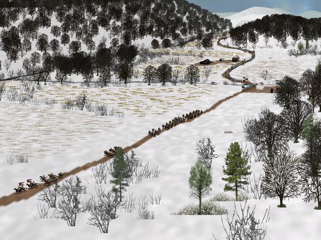
The railroad has been placed for the Patterson Creek Depot Map. I have to make some adjustments to the river where it is close to the railroad due to limitations of the map making software, but the map should be done this weekend. There is some considerable work to be done on the C&O Canal, but I think this map might just end up a substandard representation of it so that I can move on to other things.
Wednesday, September 28, 2016
Tuesday, September 27, 2016
Patterson's Creek - Still working
Patterson's Creek Depot is still under construction and being tested. I ran a quick game on it tonight it seems to be in good shape. I made a topo error again in scaling and the mountains are not nearly as high as the should be, but I have let it go. Now I am laying down railroad tracks, a long and tedious process.
Sunday, September 25, 2016
Saturday, September 24, 2016
4th Virginia Commander
I have made a correction to the Confederate OOB for the 4th Virginia (Garnett's Brigade). Originally, I had Lieut. Col. Charles Ronald listed as the commander. Then I saw that he was promoted from Capt. to Lieut. Col. in February 1862, after the period covered by the simulation. I then saw that Capt. Albert G. Pendleton had been promoted to major after all of the original field officers were no longer available. It turns out, however, that he was not promoted until January 31st. I had originally had him in the OOB as a major, but then worked on the assumption that he may have been commanding as captain prior to his promotion. However, today I got the history of the 4th Virginia through inter-library loan and found that Major Joseph Ferdinand Kent, the original major didn't resign until January 31st 1862. (I had thought it might have been earlier.) So... Major Kent will be listed as the commander on the OOB. It is possible that he was absent, but that is the best information I have available. I am assuming he resigned after the Bath-Romney Campaign, which was not highly popular with the men of Jackson's command.
Confederate OOB
I am still working on the Confederate OOB, mostly correcting commanding officers at the time of the Bath-Romney Campaign. I had incorrectly listed Col. Hume R. Field as the commander of the 1st Tennessee. In fact, it was still Col. George E. Maney. I am also making some corrections on the Virginia Militia "regiments" and trying to determine who was in command of the 4th Virginia during the 1st two weeks of January 1862,
Monday, September 19, 2016
Friday, September 16, 2016
Forks of Cacapon
I have started the topography work for the Forks of Cacapon map. It should be done in the next week or so.
Tuesday, September 13, 2016
Marching Speed Spreadsheet Done
I have completed my spreadsheets for tracking marching speeds and distances by the various marching columns.
Sunday, September 11, 2016
Almost there....
The next map in the production line will be Forks of Cacapon. It is on a turnpike, is adjacent to an objective (Slanesville) and also is the gateway to a Confederate supply line through Bloomery Gap. But week I have been working on my spreadsheets used to keep track of things while running the simulation. I have put together spreadsheets for tracking casualties and grades. (Grades affect unit quality.) I have also put together spreadsheets for tracking commissary and ordnance supplies.
The spreadsheets that are remain are movement (to track marching speeds and distances marched) and officer quality.
The spreadsheets that are remain are movement (to track marching speeds and distances marched) and officer quality.
Wednesday, September 7, 2016
Saturday, September 3, 2016
Spring Gap is posted
Spring Gap is done.
Looking west towards Spring Gap from the Moorefield Farms:
Looking east towards Spring Gap from the Critten farm:
Looking west towards Spring Gap from the Moorefield Farms:
Looking east towards Spring Gap from the Critten farm:
Friday, September 2, 2016
Next up: Spring Gap
Hainesville gives plenty of room to deploy artillery and prepare an attack. Spring Gap, not so much:
Thursday, September 1, 2016
Dutch Lick School - The Luck of a Scaling Error
Little Cacapon Mountain in the TC2M modded map for Dutch Lick School follows the same contours of the original, but ended up not being as steep. This is due to a scaling error when maping the map. By the time I realized the error, I had already placed the buildings and decided not to change it and have to make additional alterations. I will not make the same mistake a Spring Gap and Short Gap, so expect higher mountains there.
Hainesville is currently in progress and should be completed over the Labor Day weekend.
Hainesville is currently in progress and should be completed over the Labor Day weekend.
Subscribe to:
Comments (Atom)


